
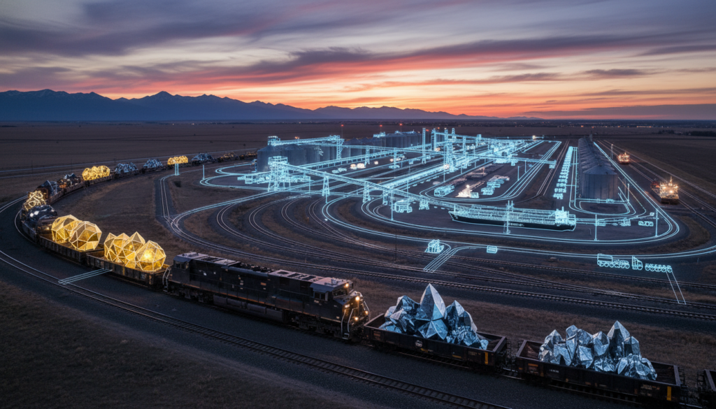

The following economic facts are based on current Alberta provincial data and market trends.
Introduction: The Great Logistical Pivot
For over a century, the economic geography of Alberta has been defined by a singular, dominant directional flow: South. The vast majority of the province’s immense natural wealth—ranging from conventional crude oil and natural gas to forestry products and agricultural yields—has historically traveled down a well-worn continental axis toward the midwestern United States and the Gulf Coast refining hubs. However, global supply chains are currently undergoing a massive structural realignment. Driven by shifting geopolitical alliances, the rapid industrialization of the Indo-Pacific region, and the imperative to secure critical mineral supply chains, Alberta is executing a strategic pivot.
At the epicenter of this monumental shift sits Grande Prairie. Traditionally viewed as a regional agricultural and forestry hub, and later as a crucial service center for the prolific Montney natural gas formation, Grande Prairie is fundamentally evolving. It is no longer merely a point of extraction; it is transforming into Alberta’s geopolitical valve to the Pacific. By acting as the critical consolidation and transload nexus for the Northern Corridor, Grande Prairie is effectively redirecting the flow of Alberta’s export economy away from landlocked American markets and toward the deep-water ports of Prince Rupert and Kitimat in British Columbia.
This article provides a comprehensive, educational blueprint of how this transformation is occurring, the logistical mechanics driving it, and what this evolution means for investors, technical engineers, business owners, and potential residents looking to capitalize on the next generation of Alberta’s economic growth.
The Historical Context: Escaping the Monopsony Trap
To fully comprehend the magnitude of Grande Prairie’s evolution, one must first understand the historical constraints placed upon the Alberta economy. For decades, Alberta has operated under the conditions of a near-monopsony regarding its primary exports. A monopsony is an economic market condition where there is essentially only one buyer—in this case, the United States.
When a massive producer is geographically landlocked and tethered by pipeline and rail infrastructure to a single primary consumer, the buyer dictates the price. This dynamic historically resulted in heavy price discounts on Western Canadian commodities. The midwestern United States refining complex, while highly efficient, represented a bottleneck that prevented Alberta from accessing global pricing parameters.
Furthermore, the traditional western route through the Rocky Mountains to the Port of Vancouver has become increasingly problematic. The southern transportation corridor, which relies heavily on the rail lines snaking through the treacherous and geographically constrained Fraser River Canyon, is fraught with challenges. It is highly susceptible to extreme weather events, atmospheric rivers, and seasonal washouts. Additionally, the Port of Vancouver itself is surrounded by dense urban sprawl, severely limiting the expansion of industrial transload facilities and creating chronic congestion and elevated “dwell times” for rail cargo.
The educational takeaway here is clear: for Alberta to maximize the valuation of its resources and ensure supply chain resilience, it required a new, unencumbered pathway to tidewater. The solution was found by looking North, bypassing the congestion of the lower mainland of British Columbia entirely.
The Geography of the Pivot: Why Grande Prairie?
The selection of Grande Prairie as the anchor for the Northern Corridor is not accidental; it is a function of pure geographic and geological advantage. Situated in the northwest quadrant of Alberta, Grande Prairie is the largest urban center in the Peace River region. It serves as the final major logistical staging ground before the topography transitions into the rugged northern Rocky Mountains.
From a macro-geographic perspective, Grande Prairie sits at the critical intersection of several major transportation arteries. It is the northern anchor of the CANAMEX trade corridor, a continuous highway system designed to link Canada, the United States, and Mexico. More importantly for the Pacific pivot, it sits directly on the primary east-west rail and highway corridors (Highway 43 connecting to Highway 16) that lead straight to the northern coast of British Columbia.
Geologically, Grande Prairie sits atop the Montney Formation. The Montney is widely considered one of the most economically robust and technologically accessible resource plays on the planet. Unlike traditional oil sands, the Montney is rich in natural gas, natural gas liquids (NGLs), and condensate. As the global energy transition accelerates, the demand for liquefied natural gas (LNG) as a transition fuel in Asian markets has skyrocketed. Grande Prairie is the natural consolidation point for this energy before it is piped westward to coastal liquefaction facilities in Kitimat.
The Mechanics of the Pacific Valve: Rail, Road, and Pipelines
The concept of a “geopolitical valve” refers to the physical infrastructure required to control, consolidate, and direct the flow of massive volumes of commodities. Grande Prairie achieves this through a triad of logistical mechanics: advanced rail networks, heavy-haul road systems, and high-capacity pipelines.
The Rail Advantage: The Direct Line to Prince Rupert
The most critical component of the Northern Corridor is the rail linkage operated primarily by Canadian National Railway (CN). The rail lines connecting the Grande Prairie region to the Port of Prince Rupert offer a profound logistical advantage over southern routes.
- Shorter Transit Times: The Port of Prince Rupert is geographically closer to major Asian ports (such as Yokohama, Shanghai, and Busan) by up to three sailing days compared to the Port of Vancouver or the Port of Los Angeles.
- Deep Water Capacity: Prince Rupert boasts the deepest natural harbor in North America, allowing it to easily accommodate the massive, next-generation Post-Panamax cargo vessels required for global bulk transport.
- Uncongested Corridors: The northern rail route experiences significantly less passenger and urban freight interference compared to the southern corridors, allowing for longer, heavier, and faster unit trains to move seamlessly from the Alberta prairies to the Pacific coast.
Grande Prairie is actively expanding its rail transload capabilities. These facilities allow bulk commodities—whether they be agricultural products, lumber, or petrochemicals—to be efficiently transferred from heavy-haul transport trucks onto railcars. By building out these consolidation yards, Grande Prairie acts as the funnel that gathers the dispersed wealth of the northwest and injects it into the Pacific-bound rail system.
Pipeline Infrastructure: The LNG Connection
While rail handles bulk and containerized freight, pipeline infrastructure is the lifeblood of the energy pivot. The Coastal GasLink pipeline, designed to carry natural gas from the Dawson Creek area (just across the border from Grande Prairie) to the LNG Canada facility in Kitimat, represents a paradigm shift. Grande Prairie serves as the operational headquarters, engineering base, and primary service hub for the extraction and midstream processing required to feed this massive export terminal.
Heavy-Haul Corridors
To feed the rail yards and pipeline compressor stations, Grande Prairie has developed a highly sophisticated network of heavy-haul roads. These engineered corridors are specifically designed to handle the immense weight of industrial equipment, logging trucks, and agricultural transport year-round, minimizing the impact of seasonal road bans that typically paralyze lesser-developed regions during the spring thaw.
Beyond Hydrocarbons: Critical Minerals and Agri-Products
While the energy sector provided the initial capital for Grande Prairie’s infrastructure buildout, the long-term educational thesis for the Northern Corridor relies on diversification. The geopolitical valve is increasingly being utilized to export two vital commodity classes: critical minerals and high-yield agricultural products.
The Critical Mineral Supply Chain
The global transition toward electrification, battery storage, and renewable energy has triggered a massive race to secure critical minerals. Alberta is uniquely positioned to capitalize on this, and Grande Prairie is the logistical gatekeeper.
- Petro-Lithium Extraction: The deep subsurface brines found within the Leduc and Montney formations are rich in lithium. Innovative extraction technologies (Direct Lithium Extraction, or DLE) are being deployed to filter lithium directly from the wastewater generated by existing oil and gas operations.
- Consolidation and Refining: Because these extraction sites are dispersed across the vast northern geography, the raw lithium concentrate must be transported to a central hub for upgrading and packaging before export. Grande Prairie’s industrial parks are perfectly zoned and equipped to host these secondary processing and consolidation facilities.
- The Export Route: Once processed, these critical minerals are containerized in Grande Prairie and shipped via the uncongested northern rail corridor to Prince Rupert, completely bypassing the United States and securing a direct, sovereign supply chain to battery manufacturers in the Indo-Pacific.
The Peace River Agricultural Boom
The Peace River region, surrounding Grande Prairie, is one of the most productive and rapidly expanding agricultural zones in Canada. As global climate patterns shift, the growing season in northern Alberta is demonstrably extending. This climatic shift is allowing for higher yields of crucial global staples.
- Canola and Pulse Crops: The region is a massive producer of canola, wheat, oats, and pulse crops (peas and lentils), which are in extremely high demand across Asian markets for both human consumption and livestock feed.
- Bypassing the Southern Bottleneck: Historically, much of this grain had to be railed south to Calgary or Edmonton before turning west toward Vancouver. The expansion of the Grande Prairie transload facilities allows local agricultural producers to load their yields directly onto Pacific-bound trains. This reduces freight costs, lowers carbon emissions associated with transport, and ensures that Alberta farmers capture a higher percentage of the global market price.
Implications for Investors, Engineers, and Businesses
Understanding the mechanics of the Northern Corridor provides actionable intelligence for various stakeholders looking to participate in Alberta’s evolving economy. The transformation of Grande Prairie from a regional hub to a geopolitical valve presents specific, structural opportunities.
For Technical Engineers and Planners
The buildout of the Northern Corridor is an engineering intensive endeavor. The demand for specialized technical expertise in this region is accelerating rapidly.
- Cold Weather Logistics: Engineers specializing in permafrost stabilization, cold-weather material sciences, and winterized automated systems are required to design facilities that can operate flawlessly in the harsh northern climate.
- Automated Transload Design: The push for efficiency is driving the need for highly automated rail-yard designs, robotic sorting facilities, and advanced telemetry systems to track bulk commodities from the farm or wellhead all the way to the hull of a ship in Prince Rupert.
- Process Engineering: As Grande Prairie moves from extraction to value-add processing (such as upgrading critical minerals or processing agricultural yields into biofuels), there is a massive requirement for chemical and process engineers to design and scale these midstream facilities.
For Institutional and Real Estate Investors
The economic gravity of the Pacific pivot is fundamentally altering the real estate and investment landscape of northwestern Alberta.
- Industrial Real Estate: There is a structural deficit in heavy industrial, rail-adjacent real estate. Investors who secure land parcels with direct access to the CN rail network and heavy-haul highway corridors are positioned to capture significant lease premiums from logistics and processing companies.
- Workforce Housing and Civic Infrastructure: As the industrial base expands, the population of Grande Prairie is projected to grow steadily. This necessitates long-term capital investment in residential development, commercial retail, and civic infrastructure to support a highly skilled, permanent workforce, moving away from the transient “camp” models of previous decades.
For Business Owners and Supply Chain Managers
For businesses operating within Alberta, the Northern Corridor offers a new strategic playbook for supply chain optimization.
- Freight Arbitrage: By utilizing the Grande Prairie to Prince Rupert route, businesses can often realize lower freight costs and faster turnaround times compared to the congested southern routes. Supply chain managers must recalculate their logistical models to account for this northern advantage.
- Secondary Processing Opportunities: The physical consolidation of raw materials in Grande Prairie creates an ecosystem ripe for secondary manufacturing. Business owners can establish facilities to process raw agricultural goods into packaged foods, or raw timber into engineered wood products, right at the logistical source before export.
Conclusion: The Architecture of Future Prosperity
The evolution of Grande Prairie is not merely a local economic success story; it is a vital component of Canada’s macroeconomic strategy. By actively constructing a reliable, high-capacity, and efficient Northern Corridor, Alberta is systematically dismantling its historical reliance on a single continental market.
The mechanics of this transition—leveraging the geographic proximity to the Montney formation, maximizing the uncongested rail links to the deep-water Port of Prince Rupert, and expanding the export base to include critical minerals and vital agricultural yields—provide a clear educational blueprint for long-term economic resilience. For engineers designing the next generation of infrastructure, investors seeking structural growth, and businesses optimizing their supply chains, Grande Prairie represents the definitive geopolitical valve connecting the wealth of the North American interior to the limitless demand of the Pacific rim.
Sources and References
- Alberta Ministry of Transportation and Economic Corridors: Strategic reports on the CANAMEX and Northern highway networks.
- Canadian National Railway (CN): Network maps and transit time data regarding the Prince Rupert corridor.
- Prince Rupert Port Authority: Deep-water capacity metrics and Asian market transit comparisons.
- Alberta Energy Regulator (AER): Geological data regarding the Montney formation and subsurface lithium brine potential.
- Statistics Canada: Agricultural yield and export data for the Peace River region.